Dorchester Illustration 2448 Gamewell Fire Alarm

2448 Gamewell Fire Alarm

Dorchester Illustration no. 2448        Gamewell Fire Alarm

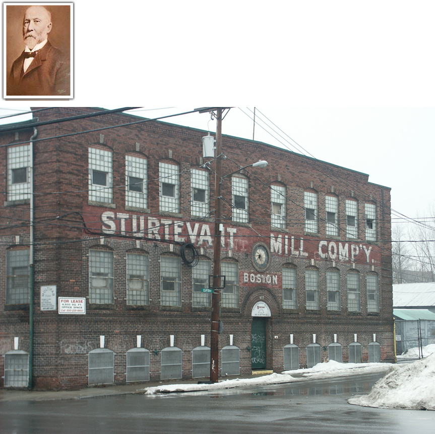
Advertisement in Fire Engineering magazine, April 1949, featuring a picture of eight-year-old Thomasina De Beneditto who pulled the fire box alarm when she observed a fire in a nearby factory in Dorchester, Massachusetts.

At the time the Gamewell Company was located in Newton. The Gamewell fire alarm was created by George Milliken who lived at 44 Virginia Street, Dorchester, from the 1880s to 1921. Milliken was renowned for his inventions. Among them were the Milliken Repeater and the Duplex System, both of which aided greatly in the development of the telegraph system. By 1867, Milliken had risen to the position of General Manager of the Boston Office of Western Union. During his tenure, he hired and oversaw the work of a young Thomas Edison as a telegraph operator. After many years of service, Milliken left Western Union and by 1885 had become the superintendent of Electrical Development and Manufacturing, a laboratory and factory on Congress Street. Three years later, Milliken was Superintendent at the Gamewell Aux. Fire Alarm Company on Pearl Street, where he stayed until his death in 1921.

So we have a Dorchester double: little Thomasina, who appeared in the ad, was a Dorchester resident, and the inventor of the alarm system had lived in Dorchester.

Posted in Uncategorized | Tagged , , , , | Comments Off on Dorchester Illustration 2448 Gamewell Fire Alarm

Dorchester Illustration 2447 Eaton Square Looking West

2447 Eaton Square Looking West

Dorchester Illustration no. 2447        Eaton Square Looking West

The postcard from 1910 shows Bowdoin Street from Eaton Square looking west.  Eaton Square is the intersection of Bowdoin Street and Adams Street at the foot of Meetinghouse Hill.  St. Peter’s Church, which is not shown, is located just to the left.  The comparison to a Google street view image shows the appearance of this location as mostly unchanged.

The 3-story brick building to the left with the cupola structure on top is the church rectory built in 1886.  The cupola is no longer there.  The next brick building is the church convent, built 1905-1906, at the corner of Bowdoin Street and Mt. Ida Road as a residence for the teachers at the church school across the street.

On the right the store fronts remain along with the mixed use commercial/residential wooden building.  The brick building on the right is St. Peter’s School erected in 1896 and finished by 1898.  The school seems to have lost its pointed structure atop the roof, although the traffic light in the Google view hides that portion of the roof.

Eaton Square is named for the Eaton Tavern that once stood at the small park at the foot of Meetinghouse Hill.  From the late 18th century to the Civil War, Percival Eaton and, later his son, Ebenezer Eaton, kept a tavern directly across from what is now St. Peter’s Church.  When the colonials prepared for the fortification of Dorchester Heights, the teamsters gathered at Eaton’s Tavern.  They drove oxcarts loaded with birch saplings for the defenses, and on the night of March 4, 1776, they proceeded to Columbia Street (Road), then north to Boston Street toward the Heights, to join the Continental troops and militia.

Posted in Uncategorized | Tagged , , | Comments Off on Dorchester Illustration 2447 Eaton Square Looking West

Dorchester Illustration 2446 Pierce Square

2446 Pierces Sq, near Milton, Dorchester, Mass003

Dorchester Illustration no. 2446        Pierce Square

This postcard from 1909 shows Pierce Square, the intersection of Washington Street, Dorchester Avenue and Adams Street.  Adams Street comes in from the right, turns the corner and leads toward the viewer.  Dorchester Avenue is the road straight ahead.  The end of Washington Street is hidden behind the building on the left.

The brick building on the right is the Pierce Mill of the Walter Baker Chocolate company. On the left, the building with the dormers was the Thayer hotel which had commercial storefronts on the first level.  It was replaced in 1911 by the Forbes Mill, a part of the Baker Chocolate operations.  The building on the corner behind the hotel was the Wendemuth block of stores, replaced by the Baker Chocolate Administration building in 1918-1919.

Henry L. Pierce was the step-nephew of Walter Baker.   He worked briefly as a clerk at the chocolate company in 1849 at the age of twenty-four.  In 1850 he moved to Milwaukee to work at a newspaper but returned to Dorchester in 1850 at the request of Sidney Williams, who was then head of Baker Chocolate.  Pierece was put in charge of the Boston counting rooms.  Williams died two years later, and Pierce leased the Baker business from the trustees.  In the next forty-two years, Pierce absorbed competing chocolate companies and constructed more and more buildings to serve the expanding business.

The Baker company and Henry Pierce became well known.  Pierce served four terms as representative in the Massachusetts General Court and later served as an Alderman in Boston.  He served as a US Representative for four years.  He purchased the Baker company outright in 1884 and incorporated it as Walter Baker & Company, Ltd in 1895.

Posted in Uncategorized | Tagged , , , | Comments Off on Dorchester Illustration 2446 Pierce Square

Dorchester Illustration 2445 Keystone Building

2445 Piano factory

Dorchester Illustration no. 2445        Keystone Building

151 Hallet Street Hallet & Davis piano factory.

The Hallet, Davis & Company was one of the early well-known American piano makers.  The firm was originally established as “Brown & Hallet” in 1835, and their factory was located on Washington Street in Boston. In 1843, Brown retired and George Davis joined the firm. Davis retired in about 1847, and Hallet became part of “Hallet, Cumston & Allen.” Allen resigned from the firm, and in 1850 he formed the “Brown & Allen Piano Company”. With Allen gone, “Hallet & Cumston” formed a partnership, building pianos under both the Hallet & Davis and the Hallet & Cumston names.  In about 1879, the business was incorporated as Hallet, Davis & Company and the Hallet & Cumston name was dropped.

In the early 1900s, the company planned for a new manufacturing building to be located in Dorchester next to the Neponset River.

The building permit to construct the building was granted to Hallet & Davis Piano Co. in 1910.  The cost for construction of the reinforced concrete building was estimated by the Boston Globe to be between $500,000 and $600,000. The Globe article on April 18, 1910, reported: The building will be on a branch of the New York, New Haven & Hartford railroad, and the Hallet & Davis piano company has a spur track of more than 1000 feet in length on its own property there.  It will also have fine dock facilities, where coal and other supplies may be brought by vessel and unloaded upon its own land.

When they applied to add a stable to the property in 1921, one of the conditions of the permit approval was that the manure pits in connection with stables were prohibited.  In 1927 the Geo. Steck Co., also a piano company, applied to build a new kiln.  In 1939 the building was owned by the Chickering piano company.  The Keystone Camera Company  seems to have come on the scene in 1955, and the building has since been known as the Keystone Building.   In 1977 a permit application was approved to convert the manufacturing facility into 223 units of housing.

Posted in Uncategorized | Tagged , , , , | Comments Off on Dorchester Illustration 2445 Keystone Building

John Foster headstone

John Foster tombstone Old Dorchester North Cemetery 1932 from BPL

Just want to share a video about this headstone, now at the Museum of Fine Arts

John Foster on You Tube video

https://www.youtube.com/watch?v=qkyj9Sg4N_0&t=0s

Posted in Uncategorized | Tagged , , , , , , , | Comments Off on John Foster headstone

Dorchester Illustration 2444 Town Hall

Town Hall

Dorchester Illustration no. 2444      Town Hall

The painting of Dorchester’s town hall is a painting from 1913 on a brick in the Edward A. Huebener Collection at the Dorchester Historical Society. The photograph was probably take just after the turn of the 20th century.  The painter, J.B.S., apparently was trying to evoke the time when the building was first constructed, because he left out the poles and trolley wires.

Edward A. Huebener, a Board member of the Dorchester Historical Society, was a collector of materials relating to Dorchester history including a very large collection of graphic materials, comprised of prints and photographs, now owned by the Society.  Huebener collected bricks obtained from Dorchester buildings, then hired a local illustrator to paint a picture of the building upon the brick, thereby creating a visual record upon an actual piece of the house.  The collection includes over 100 bricks.

Dorchester’s  Town Hall was built in 1816 on Washington Street at the southwest corner of what is now Codman Square (Washington and Norfolk Streets).

Codman Square, known at that time as Baker’s Corner, was selected for the town hall because it was (and is ) in the geographic center of the town at the only intersection of  two main east west / north south cross roads – Norfolk & Centre Streets from east to west and Washington Street from north to south. Washington Street connected the entire town to the Neponset River mills and Norfolk-Centre Streets also linked the two toll roads – Blue Hill and Dorchester turnpikes.

Second church had been built in 1806 at this intersection, and Walter Baker owned a general store at the northwest corner of the square.

The Codman Square branch of the Boston Public Library replaced the Town Hall building in 1904.  It is in Colonial Revival style with cupola and Chinese Chippendale roof balustrade. Now owned by the city but administered by the Codman Square Health Center, it is known as the Great Hall.

Posted in Uncategorized | Tagged , , , , , | Comments Off on Dorchester Illustration 2444 Town Hall

Dorchester Illustration 2443 Ashmont Station

2443 Ashmont Station 1895

Dorchester Illustration no. 2443      Ashmont Station

In 1872, the Old Colony & Newport Railway Corporation built the Shawmut Branch Railroad as a connection between the Dorchester and Milton Branch and the main line to Boston.  The new Shawmut Branch led off from the Old Colony at Harrison Square to Fields Corner, Shawmut Station and Ashmont, and the rails continued on to meet the Dorchester and Milton Branch Railroad after running through Cedar Grove Cemetery.  Ashmont became a railroad suburb before Dorchester was a streetcar suburb.  Construction of substantial houses both east and west of Peabody Square soon followed.

Until 1895 the station house for Ashmont was located at the north side of Peabody Square.  This elaborate towered building is shown in an image from an 1895 calendar issued by the Dorchester Mutual Fire Insurance Company.   A new station was built in 1895 at the south side of the intersection between the tracks and Dorchester Avenue.  The second image among the four is a real-photo postcard that shows this station, and the third image is a plan showing its layout.  The fourth image is another real-photo postcard with a photo of the brick station house built in the 1920s, when the line became electrified.

Posted in Uncategorized | Tagged , , , | Comments Off on Dorchester Illustration 2443 Ashmont Station

Dorchester Illustration 2442 Winter Garden Rollerway and Riverview Ballroom

2442 Sholes Riverview decal

Dorchester Illustration no. 2442      Winter Garden Rollerway and Riverview Ballroom

On April 30, 1932, the Winter Garden organization opened the Winter Garden Rollerway at 725 Gallivan Boulevard, located approximately where the Expressway off-ramp is now located between Staples and the gas station at Hallet Street – maybe set as far back as the Expressway itself.  Every summer beginning in June, 1933, the roller skating activity moved to Nantasket to allow the use of the facility in Dorchester as the Riverview Ballroom where many traveling name bands performed, including Rudy Vallee, Fred Waring, Isham Jones, Cab Calloway, Larry Clinton, Gene Krupa, Fats Waller, Ina Ray Hutton, Tommy Dorsey and many others. Note, however, that “jitter-bugging” was never permitted at Riverview, while the Old Time Dance Tempo of Ed Andrews caught on and became popular with dancers of all ages.

The Winter Garden Rollerway celebrated its 10th anniversary in 1942 with the publication of a booklet with photographs of many of the personnel of the organization as well as many of the skaters. The Winter Garden Tattler was published here until 1936 when its name changed to Roller Skater’s World Tattler. By 1942 this weekly publication had a circulation of 7,500 each week with demand coming from all over the country. Fred and Lou Freeman managed the entire organization.

Here is a selection of comments received about this facility:

From: Susan Liss

I skated at the Chez Vous skating ring everyday after school. I belonged to the skating club from there. Dick Dontrimont (sp) was our teacher. I have a lot of fond memories from that time. I still have my gold skate key that I got after taking a test to complete my program. The judges were all over the rink; it was some very happy times.

From: Ronald Santosucci
The Sholes rink at Neponset was located where Staples is now. Across the street where Bickford’s presently is, was Linda’s Fried Chicken. That’s where we went, after skating, (if we were fortunate enough to have the extra 0.15 cents), to get an ice cream.

I used to skate here in 1955-56. The organist’s name was Harry Garafola. I grew up in Dorchester, and South Boston…….and I not only skated at Shole’s, but also at Chez-Vous on Rhoades St. Back then, between the side entrance of the Morton theatre, and the auto parts store,(which used to be a car dealer), there was an old wooden fence which had a hole in it, and we used to cut through to get to the diner,(which used to be where the doughnut store is now). The last that I heard, Sam Sholes was living in Florida,(don’t know if he’s still alive). A pity that the young people have lost interest in the sport, and opted for video games. Trying to keep a certain culture is like trying to stop the tide…………….Ron

As a young lad back then….with no car, or license…..I didn’t have occasion to go near the Lincoln-Mercury property. I used to arrive via trackless trolley at Neponset Ave. and Gallivan Blvd. and walk to the rink. The drive-in was there, along with the Keystone Camera Company, as well as…of course…..the rink. Rayco auto seat covers was next to the car wash at the circle, (I don’t remember how long the car wash has been there). There really wasn’t a lot on Gallivan Blvd., don’t forget….the expressway wasn’t even there in 1956. That’s supposedly the reason that they destroyed the rink,(for the X-way). Hope this helps….Ron

Posted in Uncategorized | Tagged , , , , , , , , | Comments Off on Dorchester Illustration 2442 Winter Garden Rollerway and Riverview Ballroom

Dorchester Illustration 2441 361 Neponset Avenue

2441 361 Neponset Avenue, Neponset Avenue and Chickatawbut Street

Dorchester Illustration no. 2441      361 Neponset Avenue

An Unusual Case of a Divided House: Apollos Clapp

In researching the history of houses, one sometimes finds the division of a house to settle an estate.  One heir is given one side of the house, and another heir the other side.  This situation occurs along with the division of land, where the line of separation of the land goes through the house separating it into two portions.  Then two families occupy the house, keeping to their own sides.

Although division as a result of inheritance was not rare, the division of houses as a result of property seizure for payment of debts seems less common.

Apollos Clap was born in Norton, Massachusetts, on February 27, 1787, a descendant of Thomas Clapp who emigrated from England to Dorchester in the mid 1630s.

Apollos Clap acquired his home lot very soon after landowner George Minott decided to have part of his ancestral lands surveyed for sub-division.  Surveyor Mather Withington delivered a sub-division plan, dated Jan. 1, 1809, to George Minott, and on Feb. 22, 1809, Minott sold to Apollos Clap the lot that became Clap’s own home.  It is probable that Apollos built his own house in 1809 or very soon thereafter.  On January 13, 1818, Apollos married Hannah Howe, whose family lived at Neponset.  Certainly the house would have been constructed and ready to move into by the time of their marriage. In February he purchased pew 56 in the South Meetinghouse from John Codman, the minister of the church.  The distance from Clap’s home to Second Meetinghouse was about the same distance as from his home to the First Church.  His choice of Second Church may indicate that he was of conservative Congregationalist views.

Apollos was called a carpenter in the family genealogy, a housewright in certain legal documents and a gentleman in others  In the second and third decades of the 19th century, he acquired various parcels of land in the Neponset area, including house lots, orchards and marsh.  The hay from the marsh and the fruit from the orchards would have produced income to add to his earnings from his work as a carpenter. He bought and sold land; he lent money secured by mortgages.  He seems to have had a partnership with Samuel Everett of Milton in the lumber trade.

In the late 1830s Clap borrowed money and gave promissory notes on his own behalf and also through his lumber dealing partnership with Samuel Everett.  When Clap did not pay the debts, his creditors sued.  Clap lost various parcels of unimproved land and land with buildings in the years 1838 to1839 as the result of thirteen individual court judgments in favor of his creditors.  No deed of execution has been found against Everett, so we assume Everett may have disappeared or died or that he did not have any assets to seize.  The history of two of the properties include divided ownership of houses.  At that time Clap owned the property that is now 361 Neponset Avenue, where he and his family lived.  Located on the north side of Chickatawbut Street at the corner of Neponset Avenue, his Federal-style house is still extant.  He also owned property on the south side corner of Chickatawbut Street, including a cottage that is no longer standing.  The cottage must have been demolished between 1910 and 1918, because it appeared in the Bromley atlas for 1910 but not 1918.

Apollos Clap died in October of 1840, the year after the loss of his property.  By the time of his death, he had re-purchased much of the property he had lost.  The exception was the house where his family lived for more than twenty years.

Each claimant brought suit in the Court of Common Pleas.  The suits were carried over from term to term, and most were decided in December, 1838.  When Clap did not appear, the court found him in default and issued a judgment instructing the sheriff of the county to seize property of the defendant to satisfy the amount of the debt plus the costs of the suit plus the sheriff’s own costs. The sheriff was commanded to detain the defendant in the county jail until the creditors were satisfied. The sheriff appointed a committee to assess the property of the defendant for the purpose of  making an allocation of property to the claimant.  The committee made its recommendations for setting off portions of property to each of the claimants, who acknowledged satisfaction, and a deed of execution was recorded.  We must assume that Apollos Clap was held in jail from December, 1838, to April, 1839, when the executions were recorded.

The home property, now 361 Neponset Avenue, was set off in April, 1839, to James Lyford, Reuben Swan, William Gordon, Jacob Foster, Edmund J. Baker, Benjamin Franklin Glover and Amasa Hunt.  The division of land and the house followed a north-south line through the middle of the house and an east-west line dividing the east side of the house into two.

Reuben Swan, yeoman, received land including the western portion of the house and an ell extending westward. He received the use of the kitchen and the washroom or back kitchen, the cellar rooms underneath and the rooms above and the attic or garret as well as a shed or woodhouse.

William Gordon, cabinet maker, received no land, but the use of the southwest corner room was set off to him with the right to go in and out of the entry on the south side of the house.

Jacob Foster, housewright, received the southeast corner of the house and the southeast corner of the land including the entry way on the south side of the house and the use of the southeast corner room on the first floor together with a large closet opening into said room on the north of the same and right to pass and repass from the same room through the kitchen of said house this day set off to Rebuen Swan, down the cellar stairs to said Jacob’s portion of the cellar in such direction as shall do the least possible injury to said kitchen.

Benjamin Franklin Glover, yeoman received the northeast corner of the land, the northeast corner room in the house and the entry leading toward Neponset Turnpike subject to a right of passage in and out from the dwelling house to said turnpike road of all persons their heirs and assigns to whom we have appraised and set off portions of the same dwelling house this day.  He also received the use of a room in the basement directly under the northeast corner of the house with “a right to pass out around said house to the pump back of it over land this day set off to one Reuben Swan.”[1]

Edmund J. Baker, Esquire, received a small portion of land directly in front of the room set off for the use of Gordon, plus Baker received the use of the two second-floor rooms on the south side of the house and the right to pass up and down the stairs and the entry on the east side of the house. He also received the use of the cellar room immediately under the southwest corner of said house set off to Gordon with the right of passage through the kitchen to reach the cellar room.

Amasa Hunt, yeoman, received the use of the northeast corner room on the second floor with a right in said Hunt to pass and repass from said chamber, in  and out, down the front stairs, through the front entry of said house and through the front yard to the turnpike.

In the months between the setting off and the  re-sale of the property, we do not know if any of the men needed to pay expenses on the properties such as real estate taxes or maintenance.  Also we do not know if they may have rented out their portions of the house or received income in any other way from the property.  Charles H. Minot and John O. B. Minot bought out all six interests in the property during the period 1841-1843, and when Charles sold his share to John, the property came back to single ownership.

[1] Norfolk County Registry of Deeds. Book 123, Folio 71.

Posted in Uncategorized | Tagged , , , | Comments Off on Dorchester Illustration 2441 361 Neponset Avenue

Dorchester Illustration 2440 Commercial Point

2440 plan of land belonging to the Commercial Point Association 1848 cropped

Dorchester Illustration no. 2440      Commercial Point

Commercial Point is the home to the colorful gas tank we all see as we travel the Southeast Expressway as well as to the Old Colony Yacht Club.  During the 19th century, the point was considered a good place for business pursuits.  Today’s illustration is a section of an 1848 plan for Commercial Point, showing the streets at that time with illustrations of some of the Federal style houses built in the early years of the century.  The plan is A Plan of Land belonging to the Commercial Point Association, Dorchester. Sept. 30, 1835, scale 60 feet to an inch, Thomas M. Mosely, Surveyor; reduced to a scale of 200 feet to an inch by Alex Wadsworth, Surveyor, Boston, July 1, 1848.

The following is from the 1859 History of Dorchester.

“In 1807, Joseph Newell and Ebenezer Niles purchased most of Commercial Point, where they built a wharf, erected a store, built vessels and commenced a large general trade.  It proved that the location was for the time unfortunate, and that their means and business capacity were not equal to the emergencies, and the project fell through, with the ruin of the parties, in 1813.

Newell & Niles having been unfortunate in business, the Point was neglected, the buildings became dilapidated, and the place was for a long while neglected.  For a time during the war of 1812, a regiment of soldiers was stationed there.  About 1832 the place was again put in order, the fishing business was carried on to a considerable extent, and several whaling vessels were fitted out there.  After a few years the concern was sold out, and the Point is now used (1859) for the coal and lumber business, and has a large forge erected on its north-eastern extremity.”

In 1836 Elisha Preston, Josiah Stickney, Charles O. Whitmore, their associates and successors were incorporated by Commonwealth as the Dorchester Whaling Company.

From an article about Captain John Codman (son of the minister at Second Church:

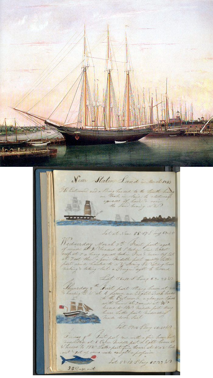
Few realize that Dorchester about 1832 was interested in whaling.  A syndicate was formed for the prosecution of the whale and cod fisheries at Commercial Point. This syndicate was composed of Messrs. Nathaniel Thayer, a brother of John E. Thayer, the founder of the house of the well-known firm of Kidder, Peabody, & Co.; Mr. Elisha Preston, of Dorchester, who was the senior part of the firm of Preston & Thayer; Mr. Josiah Stickney, a well-known Boston merchant; and Mr. Charles O. Whitmore, of the firm of Lombard & Whitmore, whose residence was near the Point, and who acted as “ship’s-husband” for the vessels composing the fleet.  Their goal was to whale in the Pacific, Indian, and North Atlantic oceans. The ships bought by the company were the “Charles Carroll,” of Nantucket; “Courier,” “Herald,” and bark “Lewis,” plus they equipped twenty schooners, of which two—the “Belle” and “the Preston”—were built at the Point.  They purchased not only the wharf, but quite a tract of land in its immediate vicinity, where they put flakes for the drying of their codfish.  They also built some cooper-shops and a store for the supply of sailors’ outfits and ship chandlery.  The store was built from the material that came from the granary building which formerly occupied the site of the present Park Street Church in the city proper.”

As noted above, by 1859, the Point was used for the coal and lumber business.    In 1872 Dexter Josiah Cutter started a heating fuel company at Commercial Point, bringing in wood and coal on boats.  The 1874 atlas shows that the Boston Gas Light Company occupied the outer portion of the Point, and John Preston had a chocolate factory and wharf at the southeastern corner. In the 1880s the Boston Gas Light Company owned nearly all of the Point and added two gas holders (coal gas tanks) along with coal shed, retort house, purifying house, condensing house, machine shop and other buildings.  D.J. Cutter maintained its coal yard at this located location through at least the 1930s.  Later they became a heating fuel delivery company located farther north on Freeport Street.

Posted in Uncategorized | Tagged , , , , , , | Comments Off on Dorchester Illustration 2440 Commercial Point