Dorchester Illustration no. 2286 St Williams Church

2286 St Williams Church postcard

Dorchester Illustration no. 2286           St. Williams Church

St. William’s became its own Parish in 1909, when it was set off from St. Peter’s; it consisted of territory south of St. Margaret’s nearly to Glover’s Corner, and included the Savin Hill district. The Reverend James J. Baxter was the first pastor and was succeeded by James McCarthy. Baxter bought the Worthington estate at the corner of Dorchester Avenue and Belfort Street, and adapted the old mansion as a rectory.  Edward Sheehan, a Dorchester resident, designed the first church building at 1048 Dorchester Avenue in the Spanish Mission.

The building was burned in September 1980 and was replaced with a church of modern design. On August 31, 2004, St. William’s joined St.Margaret’s to come the Blessed Mother Teresa parish, occupying the St. Margaret’s building at 800 Columbia Road.  Mother Teresa of Calcutta was canonized on Sunday, September 4, 2016, and Blessed Mother Teresa of Calcutta parish in Dorchester changed its name to St. Teresa of Calcutta Church.

The archive of these historical posts can be viewed on the blog at www.dorchesterhistoricalsocietyblog.org

Posted in Uncategorized | Tagged , , | Comments Off on Dorchester Illustration no. 2286 St Williams Church

Dorchester Illustration 2285 Adams Corner 1927

2285 Adams Corner 1927

Dorchester Illustration no. 2285    Adams Corner

In the late 1920s photographs were taken do document site conditions in preparation for the Southern Artery project. The project included the construction of Gallivan Boulevard from Neponset to Morton Street plus improvements along Morton Street as far as Blue Hill Avenue.  Both the Dorchester Historical Society and Historic New England own portions of this series of photographs. Just this week DHS has acquired the two photos shown as today’s illustration.  Both photos are dated November 15, 1927.

The top photo shows Adams Corner long before McDonald’s came to the corner at the right. The Ashmont Motor Co. occupies the corner on the left where Windy City Pizza is located today.

The lower photo is a 10 foot offset from the photo above. We can see the building where Gerard’s news shop and restaurant operated for many years. To the left of Ashmont Motor Co., there is a battery service store, a hardware store, a lunch shop, and bowling.


Posted in Uncategorized | Tagged , , , | Comments Off on Dorchester Illustration 2285 Adams Corner 1927

Dorchester Illustration 2284 Peabody Square Tunnel

2284 Opening of Peabody Square bridge

Dorchester Illustration no. 2284    Peabody Square subway tunnel

Boston City Archives has put a huge number of pictures online. You can view them by going to www.flickr.com.  Enter City of Boston Archives in the search box, and you will see a number of collections with many photos in each.

Today’s photograph comes from the City Archives: Northerly View of Opening of Peabody Square Bridge, Sept. 24, 1927. The photographer would have been standing in the middle of Peabody Square.  Talbot Avenue is on the left with street cars. At the far left, the building where the bike shop is located today was an auto garage with billboard on top.  At the very right, you can see a small piece of Dorchester Avenue. The building we can between the tunnel and Dorchester Avenue was a market with billboard on top.  The Archives allows downloading their images a various size.  By downloading at full size, I can see that the billboard company is Donnelly Advertising.  The billboard advertises Two Completely New Lines of Motor Cars. Fours. Sixes.  Internet searching shows that this was probably from a local Buick dealership.  In front of the market, there appears to be a small steam engine being used in the work on the tunnel.

Posted in Uncategorized | Tagged , , , , | Comments Off on Dorchester Illustration 2284 Peabody Square Tunnel

Dorchester Illustration 2283 South Bay

2283-south-bay-1871

Dorchester Illustration no. 2283    South Bay

The South Bay was a noted feature of the landscape bordering Dorchester, Roxbury and Boston. The Washington Village (Andrew) section of Dorchester was annexed to the city in 1855, following Dorchester Neck (the main part of South Boston), which was taken from Dorchester and annexed to Boston in 1805.

Today’s illustration is a bird’s-eye view published in Harper’s Weekly, July 8, 1871, showing South Boston and Columbia Point with the South Bay farther west. The railroad train on the tracks in the South Bay is about where the Newmarket station is today on the Fairmount Railroad line behind the Stop & Shop in the South Bay shopping plaza.

The map is not meant to be exact in detail, but it does provide an impression of the area. It shows the commercial activity in South Boston and some of the wharves on the South Bay.  The stream that runs into the South Bay at the left appears to be Dorchester Brook, the dividing line between Dorchester and Roxbury.  The church at the upper left is probably the Stoughton Street Baptist Church.

The archive of these historical posts can be viewed on the blog at www.dorchesterhistoricalsocietyblog.org

Posted in Uncategorized | Tagged , , | Comments Off on Dorchester Illustration 2283 South Bay

Dorchester Illustration 2282 Winter Home of the Sheep

2282-winter-home-of-the-sheep

Dorchester Illustration no. 2282    Winter Home of the Sheep

Postcard. Caption on front: Winter home of the sheep, “Franklin Field,” Dorchester. No. 2 Pub. by Boston Post Card Co. Postmarked Dec 31, 1905. Roxbury Station, Boston. With one cent stamp.

The archive of these historical posts can be viewed on the blog at www.dorchesterhistoricalsocietyblog.org

Posted in Uncategorized | Tagged , , | Comments Off on Dorchester Illustration 2282 Winter Home of the Sheep

Dorchester Illustration 23 Chickatawbut Street

KONICA MINOLTA DIGITAL CAMERA

KONICA MINOLTA DIGITAL CAMERA

Dorchester Illustration no. 2281    23 Chickatawbut Street

The house at 23 Chickatawbut Street was described in 1978 in a survey report of Neponset for the Boston Landmarks Commission:

Estimated 1840

Grand scale Greek Revival 5 Bay House; pedimented central pavilion with recessed 2nd floor window; 2 ionic columns support entrance porch, columns supporting side porches. Siding obliterates wide frieze and corner pilasters, etc. with addition to rear.  House set on granite foundation on terrace.  Once one of the grandest houses of its period in Dorchester, the house’s significance has diminished somewhat because of the siding and alterations.

Now, due to the stripping off of the siding, we can see more of the detail underneath. The photo with siding is from 2004, and the photo with siding removed is from December 2016.

The following are selected notes from the summary of the recent neighborhood meeting regarding the property.

Ted Ahern, a local developer, has recently purchased the property at 23 Chickatwabut Street. Over the years it has been used as a single family, two-family, three-family and rooming house.  It is currently a legal 3-family.  It sits on a lot that is approximately 20,000 square feet.

Mr. Ahern’s proposal is to retain the original structure of the house and remove the non-conforming additions that were added to the rear. These additions do not contribute to the character of the building.  He plans to restore the exterior of the building to its original appearance.  When complete, the building will have two condominium units, each with 3 bedrooms and two parking spaces in the rear.

In the rear of the lot, Mr. Ahern proposes to construct a new building, which will house 4 condominium townhouse units. The architect has attempted to call out the characteristics of a carriage house typical to the period.  Three of the units will have 3 bedrooms, and one will have 2 bedrooms and a nursery/office.  All will have 2 parking spaces.

Mr. Ahern also plans to retain as many of the numerous mature tress on the property as possible and clean up the landscaping.

[Editorial note: Mr. Ahern should be commended for retaining a house significant to the streetscape and significant in the history of Dorchester’s development.  He has found a way to do a development project without tearing down Dorchester’s past.]

The archive of these historical posts can be viewed on the blog at www.dorchesterhistoricalsocietyblog.org

Posted in Uncategorized | Tagged , , | Comments Off on Dorchester Illustration 23 Chickatawbut Street

Dorchester Illustration 2280 Houses at Commercial Point

KONICA MINOLTA DIGITAL CAMERA

Dorchester Illustration no. 2280     Houses at Commercial Point

Soon after 1800 Joseph Newell and Ebenezer Niles, who thought Commercial Point would prosper in whale and cod fishing, built neighboring large, square, palatial houses on the south side of the point looking south toward Port Norfolk. They connected themselves as partners in business, built vessels and were actively engaged in commercial matters, but the panic resulting from the War of 1812 put a close to their business speculations and prospects.

In the painting that is today’s illustration, Newell’s and Niles’ houses are the two white federal-style buildings that look identical.

Commercial Point served many commercial interests throughout the rest of the 19th century including Preston’s chocolate factory and wharf, a syndicate in the late 1820s and 30s for the whale fishing, and the Cutter heating fuel company. Cutter started by selling wood for heating homes and later coal.  At the end of the 19th century, Commercial Point became dominated with coal gas holders of the Boston Gas Company, and in the 20th century the Point saw the introduction of metal tanks for natural gas. Today we are left with the one colorful tank that serves as a landmark for traffic reports during the morning and evening commute along the Southeast Expressway.

The streets lost to development of the Point by Boston Gas and through the construction of the highway include: part of Preston Street, Plymouth Street, Washington Street, Pleasant Street, Neponset Street and Union Street.

The channel of water visible in the painting was Tenean Creek and its branch Barque Warwick Cove.

 The archive of these historical posts can be viewed on the blog at www.dorchesterhistoricalsocietyblog.org

Posted in Uncategorized | Tagged , , , , | Comments Off on Dorchester Illustration 2280 Houses at Commercial Point

Dorchester Illustration 2279 O’Brien’s Market

Dorchester Illus2279-obriens-markettration no. 2279     O’Brien’s Market

O’Brien’s Market will be the subject of a hearing at the Boston Landmarks Commission on Tuesday, Dec. 13, 2016, at 6:00 pm in Boston City Hall in response to a petition to designate the property a Boston landmark. The Commission has the option of accepting the petition for further study.  Please attend if you can to voice your support

O’Brien’s Market

1911-1913 Dorchester Avenue/175 Ashmont Street

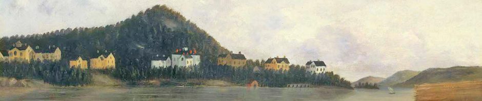
The surge in residential development in the 1880s must have presented an attractive opportunity to offer household provisions to the area’s growing and affluent population. By 1884 there were several dozen homes in the immediate vicinity, and both Carruth’s Hill and Welles Hill were primed for further development. In 1884 Messrs. Frederick P. Jacques and George C. Griffin decided to open a grocery and produce market at the corner of Dorchester Avenue and Ashmont Street in what was then called Ashmont Square.

The two proprietors of what was initially called the Ashmont Market engaged the architect W. Whitney Lewis to design a building to accommodate their provisions business and also to provide two four-room residential suites for the proprietors on the upper floors.  (George O’Brien started out as a clerk in the store in 1895, later succeeding to the ownership of the business; hence the current and long-standing name of the building.)

It is not known whether Lewis was first drawn to the Ashmont area by Messrs. Jacques and Griffin or by Frank Fairbanks, a prosperous Boston hatter, for whom Lewis designed a house at 1 Fairfax Street in 1884 (along with several other houses in that neighborhood at the same time), but regardless, in the design of the market, Whitney Lewis placed the first significant building in Peabody Square.

The Peabody Square “Ensemble”

O’Brien’s Market is a critical element in the collection of buildings that make up Ashmont’s historic village center in Peabody Square, an assemblage of 19th century structures that is National Register-eligible and exceptional in the quality and diversity of its components.  In addition to the Market, Peabody Square comprises:

The Hotel Argyle (1882-92), an architecturally complementary building to O’Brien’s, and an adjoining red-brick stable directly across the street (166-170 Ashmont Street).  The buildings were likely designed by Lewis; the stable was was remodeled to a car barn in 1910 by architects Guy and Proctor.

The Ashmont Block (1892), which housed club rooms and a large, second-floor function hall, designed by local architect-builder H.M. Wallis (164 Ashmont Street).

All Saints Church, Episcopal (1892-1894), designed by Ralph Adams Cram and Bertram Goodhue.  All Saints was individually listed on the National Register of Historic Places as a Property with National Significance in 1980 (NR #80000678) ; the 2012 Historic Structures Report prepared as part of the church’s recent restoration recommended that its status be upgraded to National Historic Landmark, which the parish intends to pursue.

Peabody Square Park (1893), a green space in the center of Peabody Square with horse-watering trough.

The Peabody Square Fire House (1895), designed by City Architect Edmund Wheelwright.

The Peabody Apartment Building (1895-1896), designed by Edwin J. Lewis, Jr.  (no relation to W. Whitney Lewis), who also designed numerous houses, primarily in the Shingle Style, in both Ashmont Hill and Carruth’s Hill. The Peabody was individually listed on the National Register of Historic Places in 2001, as a Property with Historic Significance for Architecture, Community Planning and Development (NR#01000872).

The Peabody Square Clock (1909), designed by William Downer Austin and manufactured by the E. Howard Clock Company.  It was designated a Boston Landmark by the Boston Landmarks Commission on November 1, 1983.

This remarkable and coherent ensemble of buildings and structures satisfies the National Trust’s Criteria for Evaluation A and C and might also be designated a Boston Landmark District (Criteria A and D). Each of the buildings is makes an essential contribution to the character of the Square, which enhances the neighborhoods surrounding the square as some of the most desirable in Boston.

Text from Vicki Rugo.

 The archive of these historical posts can be viewed on the blog at www.dorchesterhistoricalsocietyblog.org

Posted in Uncategorized | Tagged , , , | Comments Off on Dorchester Illustration 2279 O’Brien’s Market

Dec 11, 2016 Holiday Party + Dorchester Illustration 2278 Christmas Postcard

2278-christmas-postcard-sent-to-kilton-street-now-norwell-st-1909

Dorchester Illustration no. 2278     Christmas Postcard          

Christmas postcard sent to a home on Kilton Street (now Norwell Street) in the early 20th century.

Sunday, December 11, 2016   2pm

William Clapp House, 195 Boston Street.

Dorchester Historical Society

Holiday Party

DHS members and friends gather to ring in the holiday season at the annual Holiday Open House.  Dorchester-based pianist Bil Mooney-McCoy will play music of the holiday season and lead the gathering in a lively carol sing.  Enjoy food, good company and shopping in our specialty gift shop.

                Dorchester Historical Society

               195 Boston Street, Dorchester, MA 02125

Posted in Uncategorized | Tagged , , | Comments Off on Dec 11, 2016 Holiday Party + Dorchester Illustration 2278 Christmas Postcard

Dorchester Illustration 2277 St. William’s Church

2277-st-williams-church

Dorchester Illustration no. 2277     St. William’s Church

St. William’s became a Parish set off from St. Peter’s in 1909, consisting of territory south of St. Margaret’s nearly to Glover’s Corner, and including the Savin Hill district. The Reverend James J. Baxter was the first pastor and was succeeded by James McCarthy. Baxter bought the Worthington estate at the corner of Dorchester Avenue and Belfort Street. The old mansion was adapted as a rectory. St. William’s first building at 1048 Dorchester Avenue was in the Spanish Mission style designed by Edward Sheehan, a Dorchester resident. The Pastor in 1930 was David J. Murphy.

The building was burned in September 1980 and was replaced with a church of modern design.

From the 1990s through 2004 the Archdiocese of Boston endured the consequences of allegations and lawsuits involving misconduct by priests with the result that the Archdiocese paid out large monetary settlements. The Archdiocese studied its parishes and determined that low attendance and large expenses warranted the closing of some. St. William and St. Margaret were the only two parishes, out of 11 Catholic parishes in Dorchester, that felt a direct impact of the Archdiocese’ reconfiguration process of early 2004. In 2004, these two parishes will merged under the name of Blessed Mother Teresa parish, and the new parish is located at 800 Columbia Road in the building that was St. Margaret’s Church.  The parish is now named St. Teresa.

For more information, consult:

Emery, S.L. A Catholic Stronghold and Its Making. A History of St. Peter’s Parish, Dorchester, Massachusetts, and of Its First Rector the Rev. Peter Ronan, P.R. Boston, 1910.

Lord, Robert H., John E. Sexton and Edward T. Harrington. History of the Archdiocese of Boston. New York: Sheed & Ward, 1944. 3 vols.

Shand Tucci, Douglass. The Gothic Churches of Dorchester. Issued by the Dorchester Savings Bank. Boston: Tribune Publishing Company, 1972.

Posted in Uncategorized | Tagged , , | Comments Off on Dorchester Illustration 2277 St. William’s Church